
Erie ZIP Codes: Three Clues
The Census Erie profile places the Town across ZCTAs 80026, 80504, and 80516. A ZCTA is a statistical geography, not a promise that every address inside the Town uses that postal ZIP. The USPS ZIP Lookup is the address-level check. It can test an address, a city and state, or the cities associated with a ZIP, but its result is a mailing assignment rather than proof that a person or business is at the address.
| ZIP | Erie Relationship | Post Office | Directory Caution |
|---|---|---|---|
| 80026 | Census overlap with Lafayette-side postal geography | Lafayette Post Office, 603 S. Public Rd. | Lafayette is the last-line city, not proof of Town limits. |
| 80504 | Census overlap with the wider Longmont and Boulder-Weld area | Longmont Main Office reference | The 2009 realignment changed older postal labels. |
| 80516 | Primary Erie postal ZIP in the Census profile; it may extend beyond Town lines | Erie Post Office, 150 Wells St. | Erie as last-line city does not establish municipal residence. |
These three ZIPs belong in the Erie postal map because the Census profile records their overlap with the Town. For this Erie ZIP code directory, treat each code as a routing clue rather than a clean slice of the municipal boundary. ZIP code 80026 can carry a Lafayette last line, ZIP code 80504 can reflect the Longmont postal system, and ZIP code 80516 can reach beyond Erie. The inspected official Census profile did not include 80514 as a Town-serving overlap. Keeping that omission matters. Adding a familiar nearby ZIP without a source would make a resident search look more complete while making it less accurate.
Erie ZIP 80026: Lafayette Last Line
ZIP 80026 is the clearest example of why a postal label cannot stand in for a city map. The Census profile shows an Erie overlap, while the USPS location record identifies the Lafayette Post Office at 603 S. Public Rd., Lafayette, Colorado 80026-9998, with 303-926-1044. The postal last line can therefore say Lafayette even when the parcel, Town boundary, or local history points to Erie.
For a current address, enter the complete street address in USPS first. Preserve the returned city, state, and ZIP beside the original wording. Then compare the address with the Town's parcel layer and the correct county assessor. If the parcel is on the Boulder side, Boulder County's property search and recording system are the next public records. If the parcel is on the Weld side, use the Weld systems. A Lafayette postal label alone cannot decide which county record custodian holds the property trail. The postal guide is a routing aid, so the county and parcel check still controls the record path.
Note: The postal city in an Erie record can be Lafayette even when municipal and parcel records use Erie as the local city label.
Erie ZIP 80504 Realignment
Older address research can fail when a researcher expects today's ZIP to appear in every historic source. USPS Postal Bulletin 22259 records a Longmont delivery realignment effective July 1, 2009. It moved 8,195 deliveries from 80501 to 80504. That ZIP code realignment is a dated bridge for a deed, directory, newspaper, or family paper that uses the older ZIP.
The bulletin does not turn 80504 into a Town boundary. It explains why an address that now validates as 80504 may appear as 80501 in an earlier record. Search the street, surname, subdivision, and legal description as well as the ZIP. A historic directory may also file an Erie person under Longmont, Boulder, or Denver. When the ZIP changes but the parcel stays put, the parcel number and legal description are the stronger continuity keys.
Use the Longmont Post Office reference for the current postal location details, then verify the particular address through USPS rather than inferring delivery from a city name.
Erie ZIP 80516: Delivery Core
ZIP code 80516 is the primary Erie postal ZIP named in the Census profile. The Erie Post Office record lists 150 Wells St., Erie, Colorado 80516-9997, phone 303-828-0781, and a carrier annex at 621 Mitchell Way. Those details help confirm the postal route for a specific address, but they do not show who receives mail there or whether every 80516 address sits inside the Town. A ZIP code directory entry can identify the delivery core without proving a resident match.
Use 80516 as a useful first filter when a record already supplies it. Next, compare the address with the Town Boundary and Annexations layers, the parcel's LOCCITY, and its legal description. A delivery label answers a routing question. A parcel answers a property-location question. A voter record answers a registration question. A directory entry answers a historical contact question. They can be joined, but they should not be collapsed into one claim about a current resident.
Finding Erie Residents by ZIP
A ZIP code directory search works only when the underlying system actually stores or accepts a ZIP. Erie has an unusual mix. The Town parcel layer exposes a field called ZIPCODE, but it belongs to the owner mailing-address family. The Weld and Boulder assessor portals expose several parcel and address modes, yet the captured search screens did not show a ZIP criterion. The Colorado voter lookup accepts a ZIP only as one part of a known-person match.
- Verify the full address through USPS and save the returned ZIP with the date. Keep the original city and ZIP spelling for historic comparison.
- Open the Town of Erie parcel layer. Query
ZIPCODEonly as a mailing-side filter, then inspectFULL_ADDRE,LOCCITY, parcel, subdivision, lot, block, and legal fields. - For Weld parcels, search the Weld County Property Portal by owner, address, account, subdivision, parcel, S-T-R, API, or map. For Boulder parcels, use its address, owner, account, parcel, street-name, subdivision, or S-T-R criteria.
- For a known person, use Colorado's voter lookup with first name, last name, ZIP, and birthday. If the ZIP is wrong or the person moved, try the prior ZIP as the state page advises.
- If a formal file is needed, use the county elections request route or the Colorado voter-data request form. Request rules, protected-voter exclusions, fees, and permitted use control what can be supplied.
Once a ZIP narrows the search to a manageable set of parcels, move from the postal guide to the Erie street directory for the address-level record chain. A ZIP is a starting key, not the final identity key.
Erie Portal ZIP Search Fields
The portal mismatch is itself useful research. This ZIP code directory field map shows where a ZIP can narrow a candidate set and where an address or legal description must do the work. These are the captured field families, not a claim that every dynamic option is visible in every live session.
| Portal | Field or Mode | ZIP Behavior | Practical Use |
|---|---|---|---|
| Town GIS parcel layer | ZIPCODE; also FULL_ADDRE, LOCCITY, ADDRESS1/2 | Explicit mailing ZIP field | Filter carefully, then inspect parcel-side fields. |
| Weld Property Portal | Account, Owner Name, Address, Subdivision, Parcel, S-T-R, API, Map Search | No ZIP criterion captured | Use address or parcel fields when ZIP cannot search directly. |
| Boulder Property Search | Address, Owner Name, Account, Parcel, Street Name, Subdivision, S-T-R | No ZIP criterion in captured help | Use street, map selection, or county data downloads. |
| Colorado voter lookup | First name, Last name, Zip, Birthday | Known-person match only | Not a ZIP-wide voter roster; protected records may not appear. |
| USPS ZIP Lookup | By Address, By City and State, Cities by ZIP | Mailing verification | Returns postal routing information, not person confirmation. |
The Weld County Property Portal view captured for this postal search is a useful reminder that a property search can be ZIP-capable in its data layer without offering a ZIP box in the visible form.
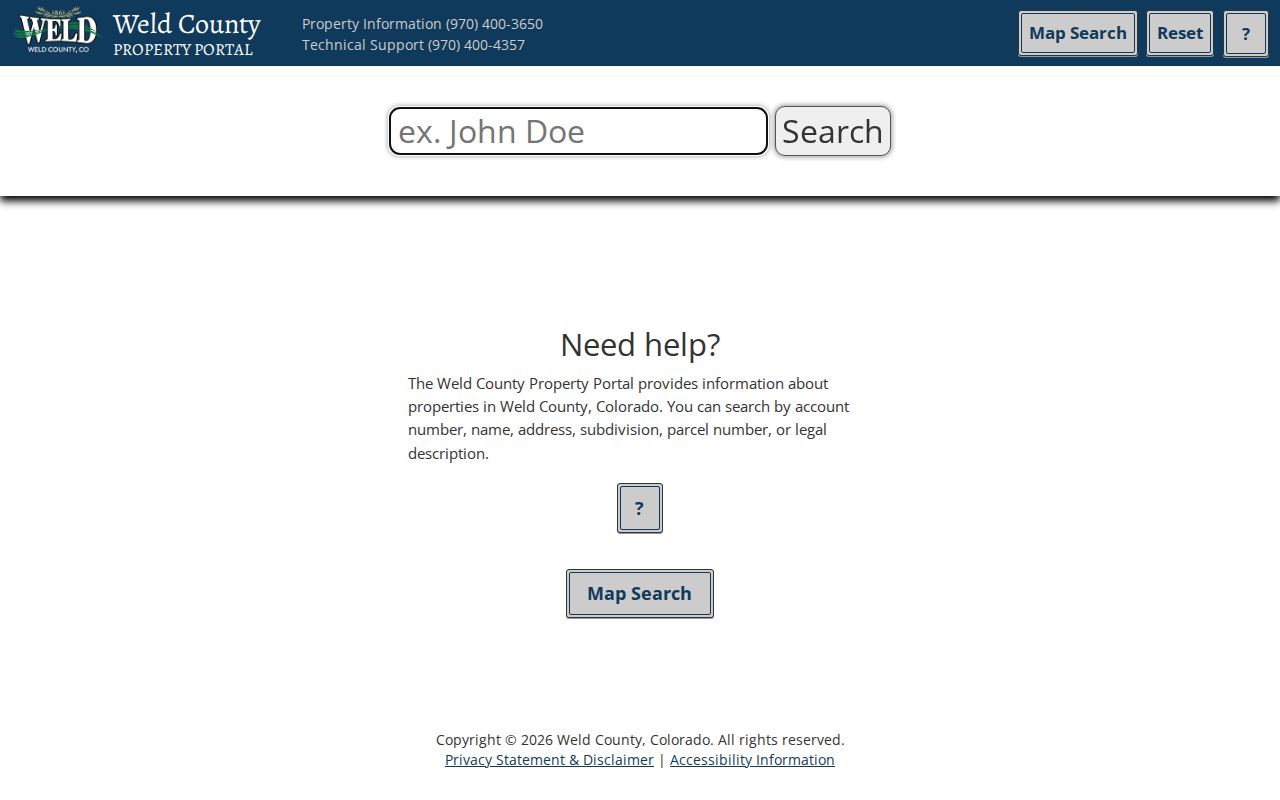
Its owner, address, parcel, subdivision, S-T-R, API, and map choices support a parcel-first route when a ZIP filter is absent. Confirm the county and preserve the source date before joining a result to a resident record.
Erie ZIP, Situs, Mailing, Legal
Four address terms often appear beside one another but answer different questions. A ZIP code is a delivery-routing label. A situs address locates the parcel or building. A mailing address tells a custodian where correspondence is sent. A legal description identifies the recorded land through subdivision, lot, block, tract, or survey language.
- ZIP and ZIP+4
- A ZIP identifies a broad delivery area. ZIP+4 adds a more precise delivery segment, but neither identifies every person connected to an address.
- PO-box ZIP
- A ZIP assigned mainly to post-office boxes serves a postal box route. No PO-box-only ZIP for the Town was located in the inspected official sources.
- Unique ZIP
- A unique ZIP can serve one organization or site. No unique-institution ZIP serving Erie was verified in the inspected sources.
- Carrier route
- A carrier route is a delivery path within a postal system. It is not a parcel boundary, neighborhood roster, or city limit.
When a recorder search misses an old street number, switch to the subdivision, lot, block, legal description, or parcel key. Those fields usually survive a postal change better than the postal label.
Erie City Lines and ZIP Boundaries
Erie crosses Boulder County and Weld County, and its postal geography overlaps neighboring last-line cities. The Town GIS has Boundary, Annexations, Tax Districts, Subdivisions, Address Points, and Erie Address Grid layers. Use those layers with a parcel record before deciding that a postal city is inside or outside the Town.
The Census profile supplies ZCTA overlap and population context. It does not draw USPS delivery polygons. The Town parcel layer's ZIPCODE is a mailing-side field, while LOCCITY, geometry, subdivision, and legal description describe the property side. A record can therefore carry Erie, Lafayette, Longmont, or Boulder in different fields without any one label being a complete answer.
Boundary check. A postal directory can narrow an Erie search, but the Town Boundary, parcel geometry, county, and USPS address result must be read together before a jurisdiction is assigned.
Note: A Census ZCTA describes statistical geography, while USPS assigns delivery ZIPs to individual addresses through its postal system.
When Erie ZIP Searches Miss
A missing result does not always mean a missing person or parcel. The ZIP may have changed, the portal may not accept ZIP searches, the mailing ZIP may differ from the situs location, or the record may be protected. County-line geography adds another failure point because the Town name does not tell the researcher which assessor or recorder owns the file.
Use the documented fallback channels when an online ZIP search stops:
- Call or email the Weld Assessor at 970-400-3650 or assessor@weld.gov, or use the public counter at 1400 N. 17th Ave., Greeley.
- Contact the Boulder Assessor at 303-441-3530 or assessor@bouldercounty.gov when the parcel routes to Boulder County.
- Use the county elections office or the Colorado voter-data request process for a defined, authorized report rather than treating the public lookup as a ZIP roster.
- Search the street, owner, subdivision, parcel, or legal description when an old ZIP or postal city is the unstable field.
Save the USPS response, portal name, county, search field, and inspection date. That small record of method makes a postal result reproducible and keeps a mailing clue from becoming an unsupported resident claim.