
Erie Neighbors by Block
Each source answers a narrower block question. The Town GIS supplies geometry and parcel fields. The county assessors supply ownership and mailing clues. Recorder indexes supply deed parties. The voter system can match a known person, but it does not offer a public street roster. ONE and HOA pages supply public association contacts, while historical directories and newspapers add a dated community layer.
| Source | What It Shows About a Block | Access and Limits |
|---|---|---|
| Town GIS Parcels and Address Points | Adjacent geometry, parcel keys, address fields, mailing values, legal and subdivision clues | Public map and REST layer; Query, Identify, distance, and selection tools; limits apply |
| Boulder and Weld assessors | Owner, parcel or account, situs address, mailing address, and property-side values | Separate county portals; no universal household filter |
| Recorder indexes | Neighbor parcel deed parties, recorded instruments, legal descriptions, and prior chains | Search each parcel through the county index; image and copy rules vary |
| Colorado voter lookup and county files | Known-person registration match, status, precinct, and formal file fields | First name, last name, ZIP, birthday; protected records may be absent |
| ONE and HOA directories | Neighborhood name, association or manager contact, and public communication path | Contact layer only; no member or occupant roster |
| Metro districts | Title 32 district governance, taxing, and public-document context | Separate quasi-governmental entities, not HOAs |
| Directories and newspapers | Historic names, phones, addresses, notices, and civic affiliations | Year-specific and incomplete; library or archive access |
| Erie Police blotter | Approximate case location, incident type, date, disposition, and clearance | Privacy-adjusted map points; not a neighbor or household list |
Owner names are not a complete block roster. A mailing address can differ from the situs address. A parcel can have several address points. A person can be connected to a block without appearing as the recorded owner. Read the source label, date, and field before joining it to a person or household.
Erie Neighbors: Parcel Method
The Town's ArcGIS service is the strongest official starting point for immediate neighbors because it begins with polygons and map relationships. The service supports Query, Identify, Export, GeoJSON or PBF output, distance, and selection operations. Its metadata states a maximum record count of 20,000 and a selection limit of 2,000. Narrow a street segment or buffer before exporting.
The Town parcel layer capture shows the adjacent-parcel fields used to move from a target address to the county record system.
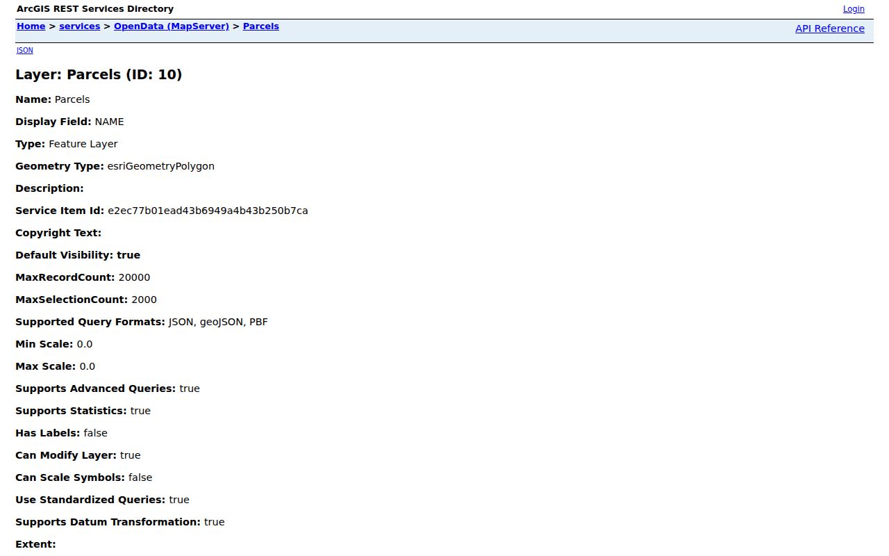
The layer can show Parcel, FULL_ADDRE, SUBNAME, LOT, BLOCK, and LEGAL values. It is a feature service, not a deed-image repository. Deed images still come from Boulder or Weld recording channels.
- Locate the target address and save its parcel or account key, map extent, street wording, and inspection date.
- Turn on Parcels, Address Points, Centerlines, Subdivisions, Town Boundary, Annexations, tax districts, and Voting Precincts.
- Click adjoining polygons or use a line, area, distance, or selection operation. Do not assume the next street number is the next parcel.
- Read the owner, mailing, situs, subdivision, lot, block, and legal fields separately. Route each parcel to Boulder or Weld.
- Add ONE, HOA, district, civic, or historical context only after the parcel set is defined. For a full named-street chain, use the Erie street directory.
Address Points and Parcels are related but not identical. A multi-unit parcel can have several address points, and a corner parcel can touch more than one street. The map tells you which polygons are adjacent. It does not tell you every person who lives inside them.
Erie Neighbors Across Boulder and Weld
Erie is a two-county records problem. Once a parcel is selected, check its legal description, subdivision, account, and local city label before choosing the county portal. The Boulder-side route runs through the Boulder County Property Search and Boulder recording. The Weld-side route runs through the Weld County Property Portal and Weld EagleWeb. A postal city or HOA name cannot replace the county check.
Compare the property or situs address with the owner mailing address. The mailing line can point to another city, a care-of contact, or several parcels. It is a tax-notice clue, not proof that the owner occupies the parcel. Then search the county recorder by party, legal description, subdivision, lot, block, document type, and date if a deed chain is needed.
Boulder Assessor
Phone 303-441-3530; assessor@bouldercounty.gov; 1325 Pearl St., Boulder, with Longmont and Lafayette office days. Use the public search first, then call or email for a parcel correction or counter route.
Weld Assessor
Phone 970-400-3650; assessor@weld.gov; 1400 N. 17th Ave., Greeley. The public counter and office route matter when the current portal does not expose a needed field.
For recorded instruments, Boulder County reports records dating to 1860, while the Weld recording index states a January 1, 1865 starting point. Online access is the first step. The recording offices supply the counter, phone, email, mail, and image or copy fallback when a neighbor parcel needs older proof.
Erie Neighborhood Contacts
The public community layer can identify a neighborhood contact without exposing a member roster. The Town's ONE program provides a registration and communication path for HOA representatives and interested residents at erieneighborhoods@erie.gov. The Town HOA directory lists associations, managers, and contact or phone information. It does not publish every household in an association.
The ONE program page is the appropriate starting point for an association question, a neighborhood contact update, or a public communication route.
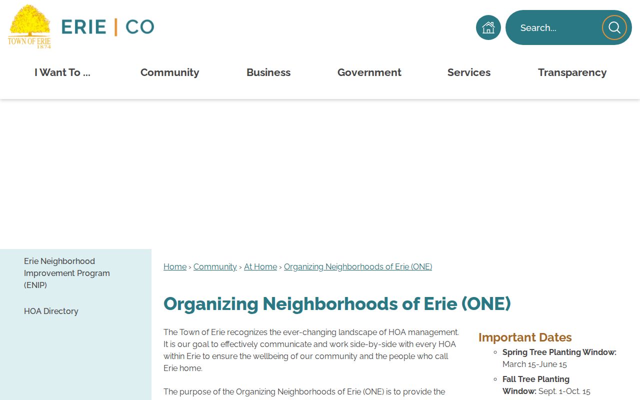
The public contact path is useful for civic connection because it points to an association or manager, not to a guessed list of people at nearby addresses.
| Community Layer | Examples or Contact Clue | What It Can Establish |
|---|---|---|
| ONE umbrella | Registration route; erieneighborhoods@erie.gov | A public communication path for neighborhood representatives and interested residents. |
| HOA directory | Arapahoe Ridge, Colliers Hill, Erie Commons, Flatiron Meadows, Vista Ridge, Wildrose | That an association or manager contact appears in the Town directory, not who belongs to it. |
| Metro district | Title 32 district pages and public documents | District governance and taxing context, separate from an HOA or resident list. |
Erie Neighbors and Voter Limits
Colorado's Find My Voter Registration tool is built for a known person. It requires first name, last name, ZIP, and birthday. It can return a registration match and status, but it does not offer an “all voters on this block” button. A wrong ZIP, recent move, spelling variant, county-line error, confidential record, protected voter, or under-18 preregistration can produce no match.
Boulder County publishes monthly SCORE voter data and request instructions through its elections data-access page. Weld County Clerk and Recorder is the local elections custodian on the Weld side. A formal file request may include residence or mailing addresses and precinct fields, but report rules, fees, permitted use, and protected-voter exclusions control delivery. The Secretary of State's request form is another documented channel for a defined report.
Use voter data to verify a known person or administrative status, not to build a block roster. The Colorado Address Confidentiality Program provides eligible survivors with a substitute address and mail forwarding. A protected voter can therefore be registered while absent from an ordinary block search.
Voter boundary. A public match is evidence of registration under the lookup's rules. It is not proof that every person at an address is present, that a non-match has left, or that a block is complete.
Erie Official Rolls vs Tools
Commercial neighbor-search tools are a category, not a primary Erie record source. They may combine old address histories, public index fragments, marketing data, and licensed datasets. Their coverage and correction paths vary. The official route is slower because each custodian answers a different question, but the source, date, field, and limitation are visible.
| Route | Useful Strength | Important Limit |
|---|---|---|
| Town GIS and parcel layer | Shows adjacent geometry, parcel keys, mailing and legal fields | Not a household roster; selection and record caps apply. |
| County assessor and recorder | Connects a parcel to recorded owners and deed parties | Owner, grantee, and mailing clues do not establish every person nearby. |
| Voter lookup or formal file | Checks a known registration and administrative fields | Requires identifiers; protected and confidential records may be withheld. |
| Commercial neighbor category | May offer one interface across mixed data sources | Can be stale, duplicate same-name records, charge fees, and lack custodian-level correction. |
For family history, civic curiosity, reconnecting with a known person, or a defined property question, cite the primary record and stop when it reaches a protected boundary. Do not turn a mixed result into a public identification of an entire block.
Historic Erie Neighbors in Block History
Earlier Erie households are often found in regional rather than town-only books. The Denver Public Library index uses *Erie and neighboring municipality searches because Erie did not consistently have a standalone phonebook. The verified 1902 regional telephone subscribers directory includes Erie, Boulder, Broomfield, Eldora, Lafayette, Longmont, Louisville, Lyons, Wallstreet, and Ward. It is a name and phone clue, not a complete household roll.
The surviving Erie-Canfield Independent issues from 1884 through 1893 add notices about town meetings, schools, mine events, businesses, marriages, deaths, and moves. The Erie Historical Society run list carries later title changes through Erie Echo. Search a date, surname, street, or event, then compare the result to a parcel, census year, deed, cemetery, or Sanborn map. Historical neighbors need a date anchor because a past notice is not a current address.
Note: A regional directory can place an Erie name under Longmont, Boulder, or Denver, so the municipality label must be searched several ways.
Erie Block Context Layers
A block profile is richer when the map layers are read as geography rather than person lists. Town GIS includes Subdivisions, Centerlines, Town Boundary, Annexations and tax districts, Erie Address Grid, Voting Precincts, schools, parks and open space, zoning, planning, and Residential Development Activity. These layers explain why adjacent parcels can fall under different administrative contexts.
Town records, council agendas and minutes, neighborhood contacts, and metro-district board materials can add civic history. The police blotter is a separate address or map-keyed event source. It updates every 24 hours Monday through Friday, excluding holidays, and adjusts locations for privacy. Search by case number or address, but do not treat a map point, incident category, or disposition as proof of a neighbor's identity or conduct.
For construction chronology, the Town permit portal and building-record request route can supply permit, inspection, plan, or Certificate of Occupancy clues. A permit identifies a project record, not a complete block household. Keep the layer name, source date, and parcel key with each observation.
Privacy Limits for Erie Neighbors
Several kinds of nearby people will not appear in an owner-centered parcel search. Household members, guests, mail recipients, utility customers, and people who have moved without a public filing are not established by a parcel name. The federal Driver's Privacy Protection Act restricts personal information from state motor-vehicle records, so a neighbor search cannot be completed through a public DMV address shortcut.
Colorado's Address Confidentiality Program, voter protections, public-record redactions, and criminal-justice rules can hide or limit a location. The Colorado Open Records Act does not require a custodian to create a new block roster or disclose information made confidential by another law. Ask for a narrow record class, date range, parcel, or case instead. Preserve the response and its reason for any withheld field.
Lawful use. Block research in Erie is appropriate for getting to know a neighborhood, civic participation, family history, reconnecting, and personal safety awareness. Colorado stalking and harassment laws, including C.R.S. §18-3-602 and C.R.S. §18-9-111, do not permit repeated unwanted contact, intimidation, or tracking of a living person.
Note: The safest block result names the target parcel, adjacent parcel, county custodian, source date, and public field without claiming more than the record shows.